Alameda Countywide Multimodal Arterial Plan
Alameda County, California
Client: Alameda County, California
Role: Subconsultant (to Fehr & Peers)
Project Duration: 2014 – 2016

Key Features
- Comprehensive framework for multimodal improvements to a countywide arterial network
- Provides starting point for community-based processes to define multimodal investments and move toward implementation at a corridor level
- Developed and analyzed GIS database to understand existing conditions and to identify multimodal emphasis for a countywide arterial network
Description
The Alameda Countywide Multimodal Arterial Plan was developed to better understand the existing and future role of the countywide arterial network as a key component of the countywide multimodal system. The plan provides a framework for the integrated management of and investment in major arterial corridors to improve overall mobility, connectivity, and safety for all users while better serving and supporting existing and future adjacent land uses. It also provides the starting point for community-based processes at a corridor level to define and implement near-, mid-, and long-term multimodal improvements.
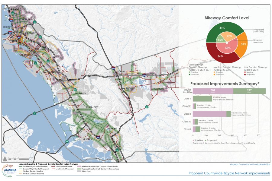
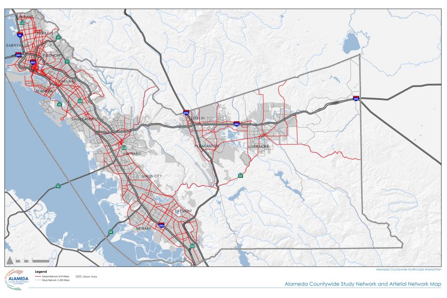
Part of a multidisciplinary team, CD+A led several plan components including creating an existing conditions GIS database regarding street characteristics, land use policy and existing use, and demographic and other characteristics associated with communities of concern. CD+A developed the multimodal and context-based street typology system that was used to develop a hierarchy of modal emphasis for the street network that is also responsive to the land use and urban character of adjacent land. CD+A performed the GIS analysis and mapping exercise to identify the tiered multimodal emphasis overlays for transit, pedestrians, bicycles, and goods movement, that were then reviewed by local agencies and revised.
Using this system, the team established a network of arterials of countywide significance, which were evaluated against a set of multimodal performance measures. This resulted in a set of improvement packages that were vetted with local agencies and transit operators, and finalized a framework of improvements to the arterial network. CD+A prepared the GIS mapping and infographics that communicate the proposed improvements and their potential benefits to the network.